26 Nights / 27 Days
Mount Nun ExpeditionFlexi PackageDelhi (2D) Leh (4D) Moving Camp (20D)
 Hotel
Hotel Meals
Meals Guide
Guide Sightseeing
 Ponies
 Porter
 Cook
Cook Wildlife Fees
 Kitchen Equipment
 Helper
 Climbing Equipment
 Rock Climbing
 Hiking
 Transportation
Activities
- Mountaineering
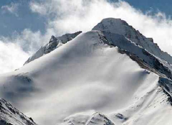
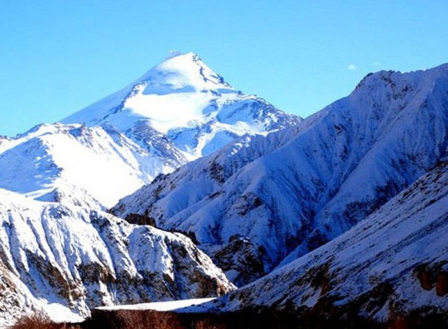
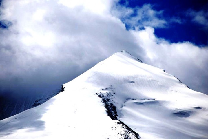
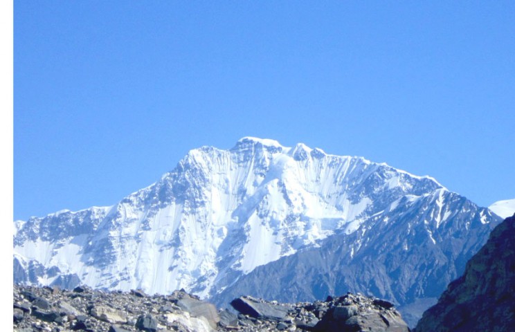
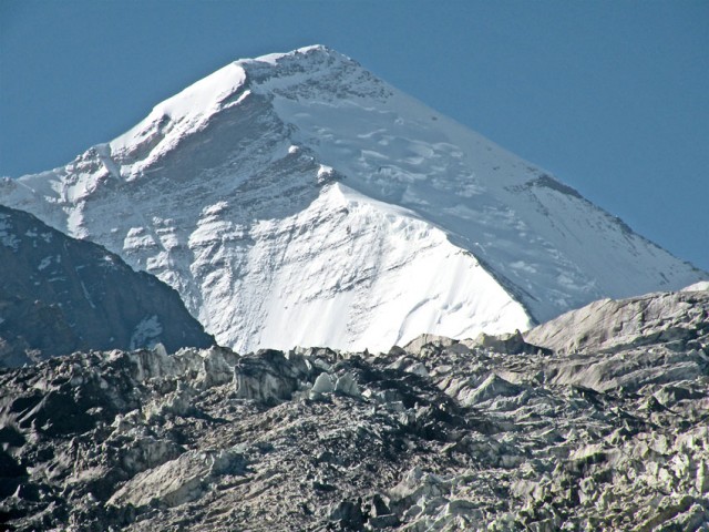
Nun is a mountain peak located in the Ladakh region of India. Here is an overview of what you can expect when undertaking a Nun Expedition:
Read MorePackage Itinerary
- Arrival DelhiDay 1Services Included
- Hotel
- Meals
- Sightseeing
- Transportation
DelhiArrives at Delhi International Airport at 0900 the following morning. Local time in Delhi is 4.5 hours ahead, but hopefully we will have been able to sleep on the flight. We are met at the airport and taken to our hotel, which is very conveniently placed for sightseeing in the city. In the afternoon, we must visit the Indian Mountaineering Federation (IMF) to obtain our climbing permit.
- Fly to Leh, the capital of LadakhDay 2Services Included
- Hotel
- Meals
- Transportation
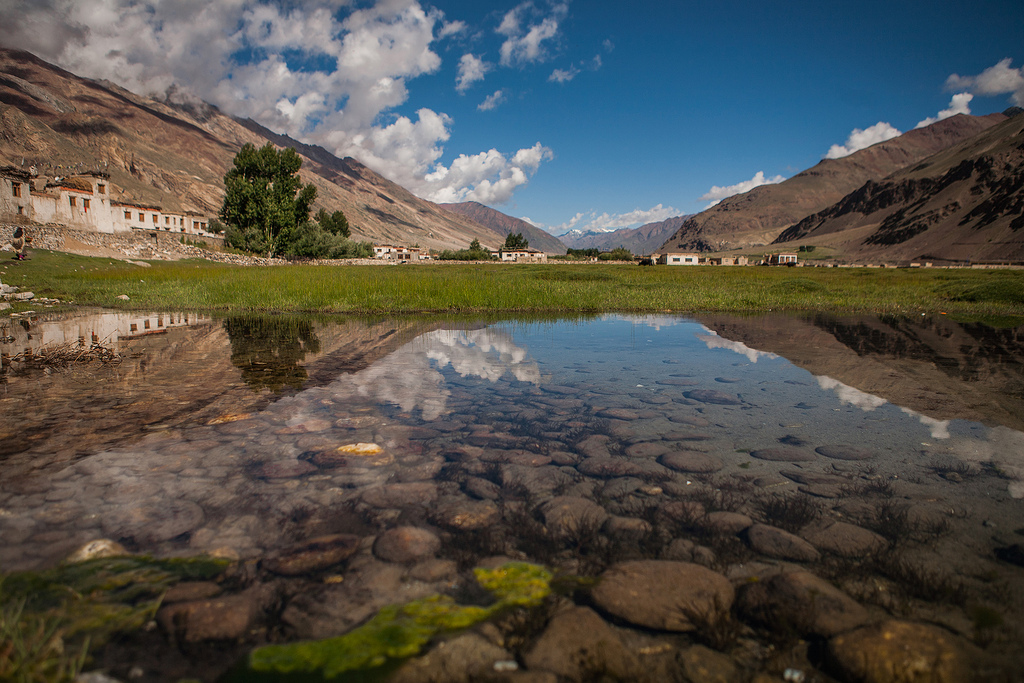
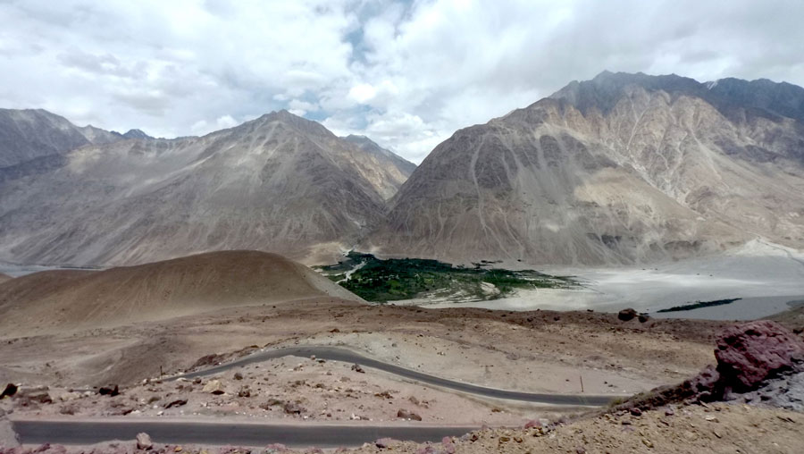
LehWe make an early start to take the flight to Leh, the capital city of Ladakh. The flight takes us over the Greater Himalaya and makes an exciting landing at one of the highest airports in the world. We can hope to get excellent views of the Zanskar Range as we fly-in and, on a clear day, the great peaks of the Karakoram are visible to the north. We are met at the airport and taken to the Kang Lha Chen. The rest of the day is at leisure. Leh is at an altitude of nearly 3,510m, and you can expect to feel the effects of the rarefied atmosphere.
- Exploring the city of LehDay 3Services Included
- Hotel
- Meals
- Sightseeing
- Transportation
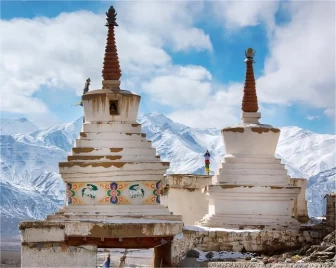
LehToday is your own to relax and stroll around Leh, to allow the effects of the altitude to wear off. This is an important period, which allows the body to acclimatise. There are plenty of distractions in Leh, varying from scenic and cultural to gastronomic. Alternatively your leader can arrange a short drive out to visit some of the fantastic monasteries that have existed here since the 11th Century.
- Drive to Heniskut and trek to Kanji Village (3,870m)Day 4Services Included
- Meals
- Guide
- Ponies
- Porter
- Cook
- Wildlife Fees
- Kitchen Equipment
- Helper
- Climbing Equipment
- Hiking
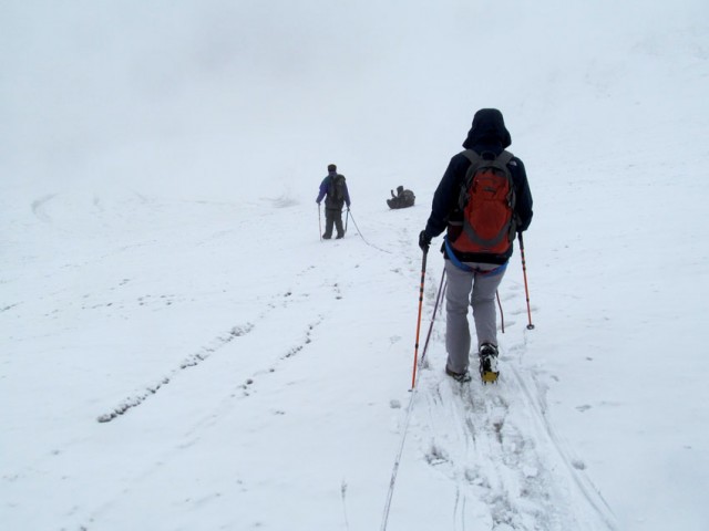
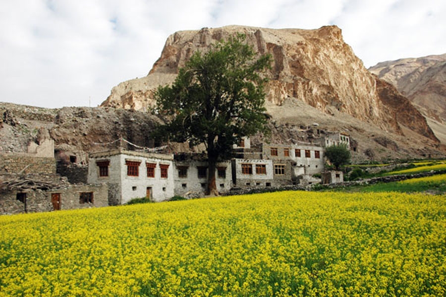
Moving CampInstead of driving directly to Kun, we will complete a three day trek to the Kanji La (5,280m), partly for the acclimatisation, but also for the opportunity to explore a little of this fascinating region. The drive to Kanji Village is an adventure in itself, firstly along the main highway from Leh to Kashmir, before turning off for the last 10Km through a spectacular gorge. It takes roughly 4 hours to get to Heniskut - which is like driving back into the middle ages. From the road head, the trek to Kanji Village takes 3 hours. This is on rough road, but it's better to walk than to drive.
- Trek to base of Kanji La (4,355m)Day 5Services Included
- Meals
- Guide
- Sightseeing
- Ponies
- Porter
- Cook
- Kitchen Equipment
- Helper
- Climbing Equipment
- Hiking
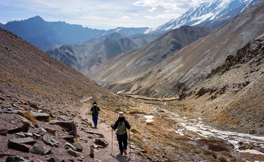
Moving CampFrom Kanji Village we trek up the floor of the valley, passing fields and seasonal settlements, criss-crossing the river (carry sandals!), to a grassy camp site at the base of Kanji La (6 - 7 hours).
- Climb to Kanji La (5,280m)Day 6Services Included
- Meals
- Guide
- Ponies
- Porter
- Cook
- Kitchen Equipment
- Helper
- Climbing Equipment
- Hiking
Moving CampSoon after leaving camp in the morning we break off heading steeply up the valley side to a pass at 4,600m, then on up a side valley to the final steep slopes which take us to the pass itself with wonderful views of the mountains of the Zanskar (4 hours from camp). A long descent down barren scree slopes to Mapollan is quite tough for the ponies (9 hours).
- End trek at Tashitongde and drive to Golmatangol (3,650m)Day 7Services Included
- Meals
- Guide
- Ponies
- Porter
- Cook
- Wildlife Fees
- Kitchen Equipment
- Helper
- Climbing Equipment
- Transportation
Moving CampWe’ll stay overnight at a campsite at Golmatangol.
- Trek to Nun Advance Base Camp (4,625m)Day 8Services Included
- Meals
- Guide
- Ponies
- Porter
- Cook
- Wildlife Fees
- Kitchen Equipment
- Helper
- Climbing Equipment
- Hiking
Moving CampTrek to Nun Advance Base Camp.
- Ascent of Nun via the West RidgeDay 9Services Included
- Meals
- Guide
- Ponies
- Porter
- Cook
- Wildlife Fees
- Kitchen Equipment
- Helper
- Climbing Equipment
- Hiking
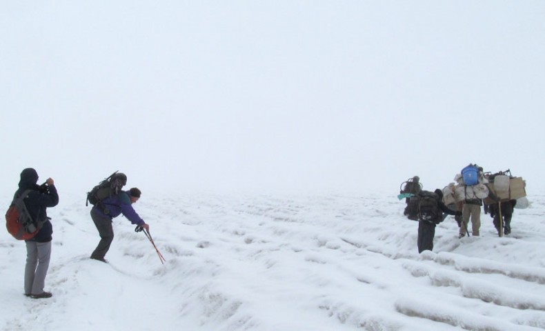
Moving CampWe need to establish three camps on the mountain and fix ropes on various sections of the route. The Sherpas will do the bulk of load carrying and fixing, but each member of the team needs to be prepared to carry their own share of the kit.
The route to Camp 1 is first up a moraine and scree slope and ridge for one hour, then onto the glacier and up an icefall with 200m of fixed line, which gives access to a huge glacial plateau.
Camp 1, at 5,500m, is on this plateau. The route from here goes across to the base of the mountain and the start of 600 vertical metres of almost continuous fixed ropes to the site of Camp 2.
Camp 2, at 6,100m, is squeezed onto a narrow sloping shelf between a glacial ridge and a vertical drop of a very long way.
Above Camp 2, a short scramble takes us onto the rocky summit of a subsidiary peak, with a steep snow slope down the other side to a crevassed col. The col gives access to snow and ice slopes, which have one short section of fixed rope and lead to the plateau at around 6,400 meter.
Camp 3 is put on this open area, giving access to the final summit slopes which terminate in a steep and narrow snow arête.
- Ascent of Nun via the West RidgeDay 10Services Included
- Meals
- Guide
- Ponies
- Porter
- Cook
- Kitchen Equipment
- Helper
- Climbing Equipment
- Hiking
Moving CampWe need to establish three camps on the mountain and fix ropes on various sections of the route. The Sherpas will do the bulk of load carrying and fixing, but each member of the team needs to be prepared to carry their own share of the kit.
The route to Camp 1 is first up a moraine and scree slope and ridge for one hour, then onto the glacier and up an icefall with 200m of fixed line, which gives access to a huge glacial plateau.
Camp 1, at 5,500m, is on this plateau. The route from here goes across to the base of the mountain and the start of 600 vertical metres of almost continuous fixed ropes to the site of Camp 2.
Camp 2, at 6,100m, is squeezed onto a narrow sloping shelf between a glacial ridge and a vertical drop of a very long way.
Above Camp 2, a short scramble takes us onto the rocky summit of a subsidiary peak, with a steep snow slope down the other side to a crevassed col. The col gives access to snow and ice slopes, which have one short section of fixed rope and lead to the plateau at around 6,400 meter.
Camp 3 is put on this open area, giving access to the final summit slopes which terminate in a steep and narrow snow arête.
- Ascent of Nun via the West RidgeDay 11Services Included
- Meals
- Guide
- Ponies
- Porter
- Cook
- Kitchen Equipment
- Helper
- Climbing Equipment
- Hiking
Moving CampWe need to establish three camps on the mountain and fix ropes on various sections of the route. The Sherpas will do the bulk of load carrying and fixing, but each member of the team needs to be prepared to carry their own share of the kit.
The route to Camp 1 is first up a moraine and scree slope and ridge for one hour, then onto the glacier and up an icefall with 200m of fixed line, which gives access to a huge glacial plateau.
Camp 1, at 5,500m, is on this plateau. The route from here goes across to the base of the mountain and the start of 600 vertical metres of almost continuous fixed ropes to the site of Camp 2.
Camp 2, at 6,100m, is squeezed onto a narrow sloping shelf between a glacial ridge and a vertical drop of a very long way.
Above Camp 2, a short scramble takes us onto the rocky summit of a subsidiary peak, with a steep snow slope down the other side to a crevassed col. The col gives access to snow and ice slopes, which have one short section of fixed rope and lead to the plateau at around 6,400 meter.
Camp 3 is put on this open area, giving access to the final summit slopes which terminate in a steep and narrow snow arête.
- Ascent of Nun via the West RidgeDay 12Services Included
- Meals
- Guide
- Ponies
- Porter
- Cook
- Kitchen Equipment
- Helper
- Climbing Equipment
- Hiking
Moving CampWe need to establish three camps on the mountain and fix ropes on various sections of the route. The Sherpas will do the bulk of load carrying and fixing, but each member of the team needs to be prepared to carry their own share of the kit.
The route to Camp 1 is first up a moraine and scree slope and ridge for one hour, then onto the glacier and up an icefall with 200m of fixed line, which gives access to a huge glacial plateau.
Camp 1, at 5,500m, is on this plateau. The route from here goes across to the base of the mountain and the start of 600 vertical metres of almost continuous fixed ropes to the site of Camp 2.
Camp 2, at 6,100m, is squeezed onto a narrow sloping shelf between a glacial ridge and a vertical drop of a very long way.
Above Camp 2, a short scramble takes us onto the rocky summit of a subsidiary peak, with a steep snow slope down the other side to a crevassed col. The col gives access to snow and ice slopes, which have one short section of fixed rope and lead to the plateau at around 6,400 meter.
Camp 3 is put on this open area, giving access to the final summit slopes which terminate in a steep and narrow snow arête.
- Ascent of Nun via the West RidgeDay 13Services Included
- Meals
- Guide
- Ponies
- Porter
- Cook
- Kitchen Equipment
- Helper
- Climbing Equipment
- Hiking
Moving CampWe need to establish three camps on the mountain and fix ropes on various sections of the route. The Sherpas will do the bulk of load carrying and fixing, but each member of the team needs to be prepared to carry their own share of the kit.
The route to Camp 1 is first up a moraine and scree slope and ridge for one hour, then onto the glacier and up an icefall with 200m of fixed line, which gives access to a huge glacial plateau.
Camp 1, at 5,500m, is on this plateau. The route from here goes across to the base of the mountain and the start of 600 vertical metres of almost continuous fixed ropes to the site of Camp 2.
Camp 2, at 6,100m, is squeezed onto a narrow sloping shelf between a glacial ridge and a vertical drop of a very long way.
Above Camp 2, a short scramble takes us onto the rocky summit of a subsidiary peak, with a steep snow slope down the other side to a crevassed col. The col gives access to snow and ice slopes, which have one short section of fixed rope and lead to the plateau at around 6,400 meter.
Camp 3 is put on this open area, giving access to the final summit slopes which terminate in a steep and narrow snow arête.
- Ascent of Nun via the West RidgeDay 14Services Included
- Meals
- Guide
- Ponies
- Porter
- Cook
- Wildlife Fees
- Kitchen Equipment
- Helper
- Climbing Equipment
- Hiking
Moving CampWe need to establish three camps on the mountain and fix ropes on various sections of the route. The Sherpas will do the bulk of load carrying and fixing, but each member of the team needs to be prepared to carry their own share of the kit.
The route to Camp 1 is first up a moraine and scree slope and ridge for one hour, then onto the glacier and up an icefall with 200m of fixed line, which gives access to a huge glacial plateau.
Camp 1, at 5,500m, is on this plateau. The route from here goes across to the base of the mountain and the start of 600 vertical metres of almost continuous fixed ropes to the site of Camp 2.
Camp 2, at 6,100m, is squeezed onto a narrow sloping shelf between a glacial ridge and a vertical drop of a very long way.
Above Camp 2, a short scramble takes us onto the rocky summit of a subsidiary peak, with a steep snow slope down the other side to a crevassed col. The col gives access to snow and ice slopes, which have one short section of fixed rope and lead to the plateau at around 6,400 meter.
Camp 3 is put on this open area, giving access to the final summit slopes which terminate in a steep and narrow snow arête.
- Ascent of Nun via the West RidgeDay 15Services Included
- Meals
- Guide
- Ponies
- Porter
- Cook
- Wildlife Fees
- Kitchen Equipment
- Helper
- Climbing Equipment
- Hiking
Moving CampWe need to establish three camps on the mountain and fix ropes on various sections of the route. The Sherpas will do the bulk of load carrying and fixing, but each member of the team needs to be prepared to carry their own share of the kit.
The route to Camp 1 is first up a moraine and scree slope and ridge for one hour, then onto the glacier and up an icefall with 200m of fixed line, which gives access to a huge glacial plateau.
Camp 1, at 5,500m, is on this plateau. The route from here goes across to the base of the mountain and the start of 600 vertical metres of almost continuous fixed ropes to the site of Camp 2.
Camp 2, at 6,100m, is squeezed onto a narrow sloping shelf between a glacial ridge and a vertical drop of a very long way.
Above Camp 2, a short scramble takes us onto the rocky summit of a subsidiary peak, with a steep snow slope down the other side to a crevassed col. The col gives access to snow and ice slopes, which have one short section of fixed rope and lead to the plateau at around 6,400 meter.
Camp 3 is put on this open area, giving access to the final summit slopes which terminate in a steep and narrow snow arête.
- Ascent of Nun via the West RidgeDay 16Services Included
- Meals
- Guide
- Ponies
- Porter
- Cook
- Kitchen Equipment
- Helper
- Climbing Equipment
- Hiking
Moving CampWe need to establish three camps on the mountain and fix ropes on various sections of the route. The Sherpas will do the bulk of load carrying and fixing, but each member of the team needs to be prepared to carry their own share of the kit.
The route to Camp 1 is first up a moraine and scree slope and ridge for one hour, then onto the glacier and up an icefall with 200m of fixed line, which gives access to a huge glacial plateau.
Camp 1, at 5,500m, is on this plateau. The route from here goes across to the base of the mountain and the start of 600 vertical metres of almost continuous fixed ropes to the site of Camp 2.
Camp 2, at 6,100m, is squeezed onto a narrow sloping shelf between a glacial ridge and a vertical drop of a very long way.
Above Camp 2, a short scramble takes us onto the rocky summit of a subsidiary peak, with a steep snow slope down the other side to a crevassed col. The col gives access to snow and ice slopes, which have one short section of fixed rope and lead to the plateau at around 6,400 meter.
Camp 3 is put on this open area, giving access to the final summit slopes which terminate in a steep and narrow snow arête.
- Ascent of Nun via the West RidgeDay 17Services Included
- Meals
- Guide
- Ponies
- Porter
- Cook
- Wildlife Fees
- Kitchen Equipment
- Helper
- Climbing Equipment
- Hiking
Moving CampWe need to establish three camps on the mountain and fix ropes on various sections of the route. The Sherpas will do the bulk of load carrying and fixing, but each member of the team needs to be prepared to carry their own share of the kit.
The route to Camp 1 is first up a moraine and scree slope and ridge for one hour, then onto the glacier and up an icefall with 200m of fixed line, which gives access to a huge glacial plateau.
Camp 1, at 5,500m, is on this plateau. The route from here goes across to the base of the mountain and the start of 600 vertical metres of almost continuous fixed ropes to the site of Camp 2.
Camp 2, at 6,100m, is squeezed onto a narrow sloping shelf between a glacial ridge and a vertical drop of a very long way.
Above Camp 2, a short scramble takes us onto the rocky summit of a subsidiary peak, with a steep snow slope down the other side to a crevassed col. The col gives access to snow and ice slopes, which have one short section of fixed rope and lead to the plateau at around 6,400 meter.
Camp 3 is put on this open area, giving access to the final summit slopes which terminate in a steep and narrow snow arête.
- Ascent of Nun via the West RidgeDay 18Services Included
- Meals
- Guide
- Ponies
- Porter
- Cook
- Wildlife Fees
- Kitchen Equipment
- Helper
- Climbing Equipment
- Hiking
Moving CampWe need to establish three camps on the mountain and fix ropes on various sections of the route. The Sherpas will do the bulk of load carrying and fixing, but each member of the team needs to be prepared to carry their own share of the kit.
The route to Camp 1 is first up a moraine and scree slope and ridge for one hour, then onto the glacier and up an icefall with 200m of fixed line, which gives access to a huge glacial plateau.
Camp 1, at 5,500m, is on this plateau. The route from here goes across to the base of the mountain and the start of 600 vertical metres of almost continuous fixed ropes to the site of Camp 2.
Camp 2, at 6,100m, is squeezed onto a narrow sloping shelf between a glacial ridge and a vertical drop of a very long way.
Above Camp 2, a short scramble takes us onto the rocky summit of a subsidiary peak, with a steep snow slope down the other side to a crevassed col. The col gives access to snow and ice slopes, which have one short section of fixed rope and lead to the plateau at around 6,400 meter.
Camp 3 is put on this open area, giving access to the final summit slopes which terminate in a steep and narrow snow arête.
- Ascent of Nun via the West RidgeDay 19Services Included
- Meals
- Guide
- Ponies
- Porter
- Cook
- Wildlife Fees
- Kitchen Equipment
- Helper
- Climbing Equipment
- Hiking
Moving CampWe need to establish three camps on the mountain and fix ropes on various sections of the route. The Sherpas will do the bulk of load carrying and fixing, but each member of the team needs to be prepared to carry their own share of the kit.
The route to Camp 1 is first up a moraine and scree slope and ridge for one hour, then onto the glacier and up an icefall with 200m of fixed line, which gives access to a huge glacial plateau.
Camp 1, at 5,500m, is on this plateau. The route from here goes across to the base of the mountain and the start of 600 vertical metres of almost continuous fixed ropes to the site of Camp 2.
Camp 2, at 6,100m, is squeezed onto a narrow sloping shelf between a glacial ridge and a vertical drop of a very long way.
Above Camp 2, a short scramble takes us onto the rocky summit of a subsidiary peak, with a steep snow slope down the other side to a crevassed col. The col gives access to snow and ice slopes, which have one short section of fixed rope and lead to the plateau at around 6,400 meter.
Camp 3 is put on this open area, giving access to the final summit slopes which terminate in a steep and narrow snow arête.
- Ascent of Nun via the West RidgeDay 20Services Included
- Meals
- Guide
- Ponies
- Porter
- Cook
- Kitchen Equipment
- Helper
- Climbing Equipment
- Hiking
Moving CampWe need to establish three camps on the mountain and fix ropes on various sections of the route. The Sherpas will do the bulk of load carrying and fixing, but each member of the team needs to be prepared to carry their own share of the kit.
The route to Camp 1 is first up a moraine and scree slope and ridge for one hour, then onto the glacier and up an icefall with 200m of fixed line, which gives access to a huge glacial plateau.
Camp 1, at 5,500m, is on this plateau. The route from here goes across to the base of the mountain and the start of 600 vertical metres of almost continuous fixed ropes to the site of Camp 2.
Camp 2, at 6,100m, is squeezed onto a narrow sloping shelf between a glacial ridge and a vertical drop of a very long way.
Above Camp 2, a short scramble takes us onto the rocky summit of a subsidiary peak, with a steep snow slope down the other side to a crevassed col. The col gives access to snow and ice slopes, which have one short section of fixed rope and lead to the plateau at around 6,400 meter.
Camp 3 is put on this open area, giving access to the final summit slopes which terminate in a steep and narrow snow arête.
- Ascent of Nun via the West RidgeDay 21Services Included
- Meals
- Guide
- Ponies
- Porter
- Cook
- Kitchen Equipment
- Helper
- Climbing Equipment
- Hiking
Moving CampWe need to establish three camps on the mountain and fix ropes on various sections of the route. The Sherpas will do the bulk of load carrying and fixing, but each member of the team needs to be prepared to carry their own share of the kit.
The route to Camp 1 is first up a moraine and scree slope and ridge for one hour, then onto the glacier and up an icefall with 200m of fixed line, which gives access to a huge glacial plateau.
Camp 1, at 5,500m, is on this plateau. The route from here goes across to the base of the mountain and the start of 600 vertical metres of almost continuous fixed ropes to the site of Camp 2.
Camp 2, at 6,100m, is squeezed onto a narrow sloping shelf between a glacial ridge and a vertical drop of a very long way.
Above Camp 2, a short scramble takes us onto the rocky summit of a subsidiary peak, with a steep snow slope down the other side to a crevassed col. The col gives access to snow and ice slopes, which have one short section of fixed rope and lead to the plateau at around 6,400 meter.
Camp 3 is put on this open area, giving access to the final summit slopes which terminate in a steep and narrow snow arête.
- Ascent of Nun via the West RidgeDay 22Services Included
- Meals
- Guide
- Ponies
- Porter
- Cook
- Kitchen Equipment
- Helper
- Climbing Equipment
- Hiking
Moving CampWe need to establish three camps on the mountain and fix ropes on various sections of the route. The Sherpas will do the bulk of load carrying and fixing, but each member of the team needs to be prepared to carry their own share of the kit.
The route to Camp 1 is first up a moraine and scree slope and ridge for one hour, then onto the glacier and up an icefall with 200m of fixed line, which gives access to a huge glacial plateau.
Camp 1, at 5,500m, is on this plateau. The route from here goes across to the base of the mountain and the start of 600 vertical metres of almost continuous fixed ropes to the site of Camp 2.
Camp 2, at 6,100m, is squeezed onto a narrow sloping shelf between a glacial ridge and a vertical drop of a very long way.
Above Camp 2, a short scramble takes us onto the rocky summit of a subsidiary peak, with a steep snow slope down the other side to a crevassed col. The col gives access to snow and ice slopes, which have one short section of fixed rope and lead to the plateau at around 6,400 meter.
Camp 3 is put on this open area, giving access to the final summit slopes which terminate in a steep and narrow snow arête.
- Ascent of Nun via the West RidgeDay 23Services Included
- Meals
- Guide
- Ponies
- Porter
- Cook
- Kitchen Equipment
- Helper
- Climbing Equipment
- Hiking
Moving CampWe need to establish three camps on the mountain and fix ropes on various sections of the route. The Sherpas will do the bulk of load carrying and fixing, but each member of the team needs to be prepared to carry their own share of the kit.
The route to Camp 1 is first up a moraine and scree slope and ridge for one hour, then onto the glacier and up an icefall with 200m of fixed line, which gives access to a huge glacial plateau.
Camp 1, at 5,500m, is on this plateau. The route from here goes across to the base of the mountain and the start of 600 vertical metres of almost continuous fixed ropes to the site of Camp 2.
Camp 2, at 6,100m, is squeezed onto a narrow sloping shelf between a glacial ridge and a vertical drop of a very long way.
Above Camp 2, a short scramble takes us onto the rocky summit of a subsidiary peak, with a steep snow slope down the other side to a crevassed col. The col gives access to snow and ice slopes, which have one short section of fixed rope and lead to the plateau at around 6,400 meter.
Camp 3 is put on this open area, giving access to the final summit slopes which terminate in a steep and narrow snow arête.
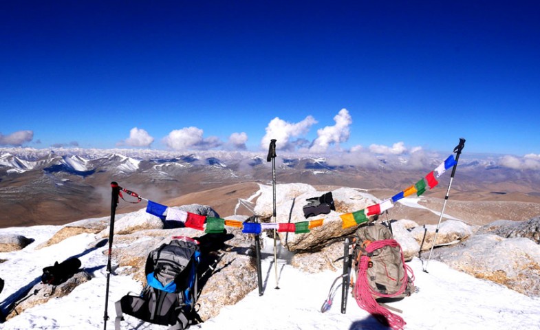
- Return to LehDay 24Services Included
- Hotel
- Meals
- Guide
- Ponies
- Porter
- Cook
- Kitchen Equipment
- Helper
- Climbing Equipment
- Hiking
- Transportation
LehThe return journey can be done in two days. The walk from ABC to Tangol takes less than 4 hours and the drive to Kargil takes another 3 or 4. The drive back to Leh from Kargil takes anything from 6 to however many hours depending on traffic, road conditions, landslides, roadworks and the like.
- Return to LehDay 25Services Included
- Hotel
- Meals
- Transportation
LehReturn to Leh. The return journey can be done in two days. The walk from ABC to Tangol takes less than 4 hours and the drive to Kargil takes another 3 or 4. The drive back to Leh from Kargil takes anything from 6 to however many hours depending on traffic, road conditions, landslides, roadworks and the like.
- Transfer to Leh AirportDay 26Services Included
- Hotel
 Breakfast
- Transportation
DelhiDe-briefing at the IMF.
- Transfer to Delhi AirportDay 27Services Included
 Transfers
DelhiTransfer to Airport
Policy
- Inclusions
- Accommodation in Delhi on Bed & Breakfast Basis & in Leh on Full Board for Nun/Kun Expediton Packages.
- All transportation by Toyota Qualis, Innova or Scorpio.
- Two men tent, Kitchen and dinning tents.
- Kitchen equipments and Toilet Tent.
- Stool, Table and mattresses.
- Food veg and non-veg.
- Cook, helper and Mountaineering guide.
- Horse for Luggages.
- Innerline permit, wild life fees and camping charges.
- Indian Mountaineering Climbing charges (only for foreign Nationality)
- Climbing Equipments.
- Exclusions
- Indian Mountaineering Climbing charges for Indian Nationality
- Sleeping Bags, trekking shoes and clothing.
- Any Airfare.
- Any Kind of Personal Expenses or Optional Tours / Extra Meals Ordered
- No accommodation in Leh is included in Trekking Packages except Nun & Kun Packages.
- Any thing not specifically mentioned under the head “Prices Included”.
- Tips, Insurance, Laundry, Phone Calls.
- Any Kind of Drinks (Alcoholic, Mineral, Aerated)
- Cost incidental to any change in the itinerary/ stay on account of flight cancellation due to bad weather, ill health, roadblocks and/or any factors beyond control.
- Cancellation Policy
- 10% cancellation charges if the trekking is cancelled within 30 days before the tour.
- 20% cancellation charges if the tour and trek is cancelled within a one week before the tour.
- No refund if the trek or tour is cancelled after starting or middle of the trek or tour.
- Terms and Conditions
- Prices valid from 01 May 2025 to 30 September 2025.
- Special Note
Acclimatization: Ladakh is known for its high altitude, and lack of oxygen can lead to altitude sickness. Ensure proper acclimatization by gradually ascending to higher altitudes, staying hydrated, and allowing your body time to adjust.
Permit Requirements: Check and obtain all necessary permits for mountaineering in the region. Ladakh has specific regulations, and permits are often required for trekking and mountaineering in certain areas.
Weather Conditions: Ladakh experiences extreme weather conditions, including cold temperatures and high winds. Be prepared for sudden changes in weather, and pack accordingly with warm clothing and waterproof gear.
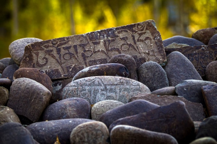
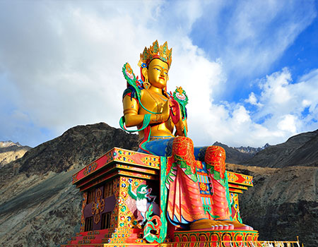
Cultural Sensitivity: Ladakh has a rich cultural heritage, and it's important to respect local customs and traditions. Seek permission before entering religious sites, and be mindful of the local communities and their way of life.
Environmental Conservation: Practice Leave No Trace principles to minimize your impact on the environment. Avoid littering, stay on designated trails, and follow responsible waste disposal practices.
Water and Food: Carry sufficient water, as dehydration can occur quickly at high altitudes. Additionally, bring high-energy snacks and meals to sustain yourself during the trek.
Communication: Due to the remote and challenging terrain, mobile phone reception may be limited. Consider carrying a satellite phone or a communication device for emergencies.
Guides and Local Support: Engage local guides and support staff who are familiar with the region. They can provide valuable insights, enhance safety, and contribute to the local economy.
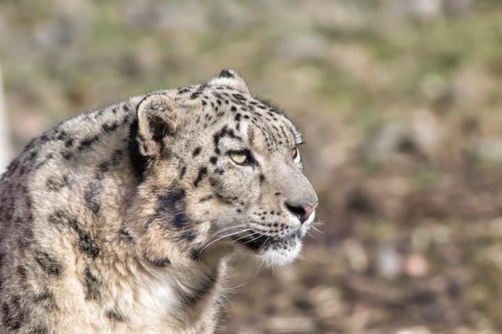
Wildlife Awareness: Ladakh is home to unique wildlife, including snow leopards and Himalayan marmots. Respect their habitats, maintain a safe distance, and avoid disturbing the local fauna.
Emergency Preparedness: Be prepared for emergencies with a well-equipped first aid kit. Know the emergency evacuation procedures and have contact information for local authorities and medical facilities.
Planning and Preparetion: Always check with local authorities or experienced mountaineering agencies for the latest information and guidance specific to your planned route and activities in Ladakh. Safety should be a top priority, and proper planning and preparation are crucial for a successful mountaineering experience in this challenging and breathtaking region.
Your Preference

Dear Overland Escape, My family just returned back from Leh and we all agreed that we left part of our heart there - and one of the biggest reasons w ...
Our trip was even more memorable and enjoyable because of the facilities that Overland Escape provided us.Mr. Tunduk Namgyal, who drove us in and a ...

It's been a week since we've returned to the hustle and bustle of Hong Kong and we haven't stopped raving and reminiscing about the fabulous time w ...

Overland Escape helped us discover the amazing Nubra Valley, then guided us through the spectacular Markha Valley trek and also arranged for a succ ...

Thank you very much for your all Support & Service.Hotel, Bike & tents all the services are up to the Mark. We must say the correct and pro ...

That’s about all Ladhkhi I could learn in one week from Tundup.Recently my wife and me had the pleasure of visiting Leh and some of the p ...